- Español
- English
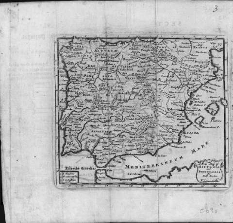
A New Map of Hispania and Portugallia


Library: Regional Library of Madrid
Uniform Title: España. Mapas generales. ca. 1690
Title: A New Map of Hispania and Portugallia [Material cartográfico] / by Robt. Morden
Área de datos: Escala [ca. 1:1.800.000]
Publication: [London : s.n., 1690?]
Physical description: 1 mapa : grab. ; 12 x 14 cm en h. de 18 x 19 cm
Notes: En ángulo superior derecho: "Pag. 53"
Márgenes graduados. Red hidrográfica. Costas sombreadas
Toponimia en español y latín
Datos de publicación tomados del catálogo del librero
Título en cartela con cornucopia
Subject / place / event: España - Mapas
Portugal - Mapas
Other authors: Morden, Robert, m. 1703
Secondary titles: Portugal. Mapas generales. ca. 1690
Document type:
 Maps
Maps
Copyright:


![]()
© BPCM 2013-2020