- Español
- English
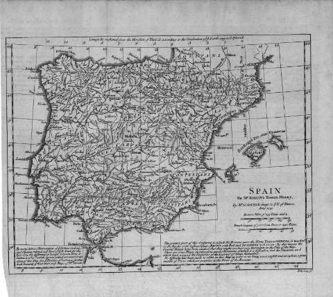
Spain, for Mr. Rollin's Roman History : [map]


Library: Regional Library of Madrid
Uniform Title: España. Mapas generales. 1741
Title: Spain, for Mr. Rollin's Roman History [Material cartográfico] : [map] / by Mr. D'Anville, Geogr. to ye. K. of France, June 1741 ; R . W. Scale fct
Área de datos: Escala [ca. 1:5.200.000]. 150 Roman Miles of 755 Toises and 1/2 [= 4,3 cm]
Publication: [S.l. : s.n.], 1741
Physical description: 1 mapa ; 21 x 27 cm en h. de 27 x 30 cm
Notes: Escala expresada en otras unidades
Márgenes graduados. Meridiano de origen: París
Abundante toponimia en latín. Red hidrográfica. Relieve por montes de perfil y sombreado. Costas sombreadas
Incluye texto informativo sobre el mapa en inglés
Subject / place / event: España - Historia - Edad antigua, hasta 414 d.C. - Mapas
Portugal - Historia - Edad antigua, hasta 414 d.C. - Mapas
Other authors: Anville, Jean Baptiste Bourguignon d', 1697-1782
Rollin, Charles, 1661-1741
Scale, R. W.
Secondary titles: Portugal. Mapas generales. 1741
Document type:
 Maps
Maps
Copyright:


![]()
© BPCM 2013-2020