- Español
- English
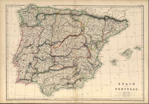
Spain and Portugal : [map]


Library: Regional Library of Madrid
Uniform Title: España. Mapas generales. ca. 1860
Title: Spain and Portugal [Material cartográfico] : [map] / drawn by Edwª Weller F.R.G.S. ; engraved by Edwª Weller
Área de datos: Escala [ca. 1:2.500.000]. 100 Geographical Miles 60 one degree [=7,3 cm]
Publication: Glasgow ; Edinburgh ; London : Blackie & Son, [1860?]
Physical description: 1 mapa : grab.,col. ; 34 x 49 cm en h. de 38 x 54 cm
Notes: En ángulo superior izquierdo aparece: "XXXIV"
Probablemente este mapa formó parte del "The Imperial Atlas of Modern Geography", London 1860 (Tooley's dictionary of mapmaker, 1999- , p. 143)
Escala expresada también en otras unidades
Márgenes graduados. Dibujados meriadianos y paralelos formando cuadrícula
Relieve representado por normales. Divisiones administrativas diferenciadas por color. Toponimia en inglés y español
Subject / place / event: España - Mapas
Portugal - Mapas
Other authors: Weller, Edward
Secondary titles: Portugal. Mapas generales. ca. 1860
Document type:
 Maps
Maps
Copyright:


![]()
© BPCM 2013-2020