- Español
- English
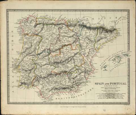
Spain and Portugal : [map]


Library: Regional Library of Madrid
Uniform Title: España. Mapas generales. 1845
Title: Spain and Portugal [Material cartográfico] : [map] / by Philip Smith Univ. Coll. London ; published under the superintendence of the Society for the Diffusion of Useful Knowledge ; J. & C. Walker sculp
Área de datos: Escala [ca. 1:3.200.000]. 40 Spanish Leagues 16,4 = 1 Degree [=7 ,8 cm]
Publication: London : Charles Knight & Co., 1845
Physical description: 1 mapa : grab.,col. ; 29 x 37 cm en h. de 35 x 41 cm
Notes: Escala expresada también en otras unidades
Márgenes graduados. Dibujados meriadianos y paralelos formando cuadrícula
Relieve representado por normales y sombreado. Divisiones administrativas diferenciadas por líneas de color. Toponimia en inglés y español
Subject / place / event: España - Mapas
Portugal - Mapas
Other authors: Society for the Diffusion of Useful Knowledge (Gran Bretaña)
J. & C. Walker (Firma)
Secondary titles: Portugal. Mapas generales. 1845
Document type:
 Maps
Maps
Copyright:


![]()
© BPCM 2013-2020