- Español
- English
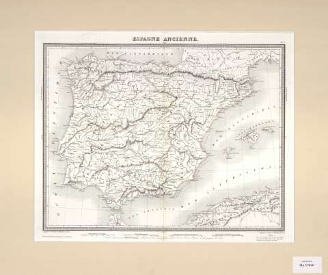
Espagne ancienne : [carte]


Library: Regional Library of Madrid
Uniform Title: España. Mapas generales. 1840?
Title: Espagne ancienne [Material cartográfico] : [carte] / dressée et gravée par Ambroise Tardieu
Área de datos: Escala [ca. 1:3.065.131]. 120 Milles Romains de 75 au degrée [=5 ,8 cm]
Publication: [Paris? : s.n., 1840?]
Physical description: 1 mapa ; 34 x 43 cm
Notes: En ángulo superior derecho: Nº 7. En ángulo inferior derecho: "cette carte est écrite en partie d'après les Tableaux composés par Mr. Romey pour la Géographie comparée de l'Espagne ancienne"
Escala expresada también en otras unidades
Márgenes graduados
Longitud oriental y occidental del meridiano de París
Abundante toponimia. Red hidrográfica representada
Relieve representado por montes de perfil y sombreado
Fecha de publicación tomada del catálogo del librero
Subject / place / event: España - Historia - Edad antigua, hasta 414 d.C. - Mapas
Portugal - Historia - Edad antigua, hasta 414 d.C. - Mapas
Other authors: Tardieu, Ambroise, 1788-1841
Document type:
 Maps
Maps
Copyright:


![]()
© BPCM 2013-2020