- Español
- English
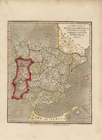
A new map of Spain and Portugal : divided into their...


Library: Regional Library of Madrid
Uniform Title: España. Mapas generales. 1811
Title: A new map of Spain and Portugal [Material cartográfico] : divided into their respective kingdoms and provinces / by William Darton engraver
Área de datos: Escala [ca. 1:4.700.000]. 150 British Statute Miles [=5,1 cm]
Publication: London : Printed and Published Septr. 26. 1811, by Willm. Darton, 58 Holborn Hill, 1811
Physical description: 1 mapa : grab., col. ; 29 x 24 cm en h. de 39 x 29 cm
Notes: Título en la parte superior derecha
Márgenes graduados. En el margen superior e inferior se dan las longitudes referidas al meridiano de Londres. Relieve por montes de perfil y sombreado. Hidrografía. Red viaria. Toponimia en inglés con nombres en español y portugués. Mares representados por un fino rayado
Ámbito geográfico: Abarca también parte del norte de África y el sur de Francia
Inserta en el ángulo inferior derecho: "The Kingdom of Majorca"
Subject / place / event: España - Mapas
Portugal - Mapas
Other authors: Darton, William , Junior, fl. 1804-1835
Secondary titles: Portugal. Mapas generales. 1811
Document type:
 Maps
Maps
Copyright:


![]()
© BPCM 2013-2020